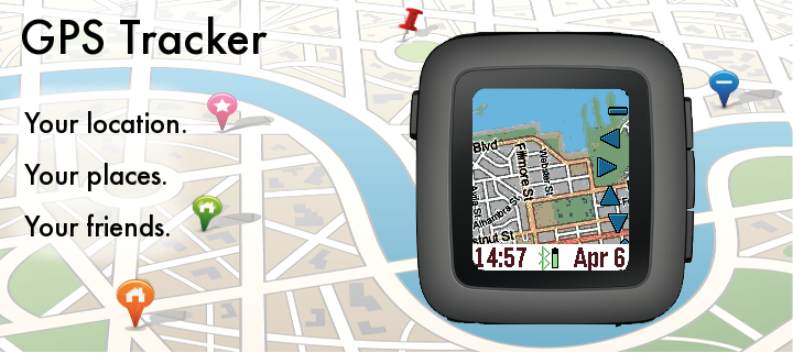
The GPS Tracker app is a powerful wrist map, and can also be used to track your pals.
The top button activates the backlight, and the bottom button pans the map depending on the tilt of the watch. The middle (select) button activates the menu wheel.
The menu wheel has options for updating your location, zooming in (+) and out (-), panning, markers (X), and custom settings.
To drop a marker, pan the map and choose "Add New Marker" from the markers menu. You can customize the marker label in the Settings page. The last choice in the markers menu is GeoLocation for displaying the street address.
If you give yourself a NAME and specify a GROUP in the Settings screen through the Pebble Time phone app, then your location will be shared with others in the same GROUP. Use the group name "public" to see others that want to be seen. The “Wakeup” feature can be used to periodically send your GPS to your pals, even if the GPS Tracker is not active.
The settings menu contains many options, including map service, process image, date format, and more. For the process image settings, you can choose to dither and/or boost the contrast of the mapping tiles for better readability. Location refresh is how often the GPS on the smart phone is queried.
Mapping tiles Copyright and courtesy of OpenStreetMap, OpenStreetMap contributors, DigitalGlobe, Google Maps, ESRI ArcGIS, Bing maps, Stamen, and NOAA. Stamen data by Stamen Design (http://stamen.com); OpenStreetMap (http://openstreetmap.org) mapping tiles under Creative Commons licenses.
- App Website:
- /tracker

Latest Version: 1.8
Version History:
0.0 created March 29, 2016
0.1 fixed name/group problem
0.2 all services on B&W Pebble
0.3 patched menu-based settings
1.0 added Bing; official release
1.1 removed debugging information (oops!)
1.2 reduced cache period
1.3 replaced MapQuest by DigitalWorld
1.4 revised DigitalWorld map
1.5 added NOAA nautical chart
1.6 Pebble 2 support
1.7 Pebble OG fix
1.8 Patch for new Pebble Time Android