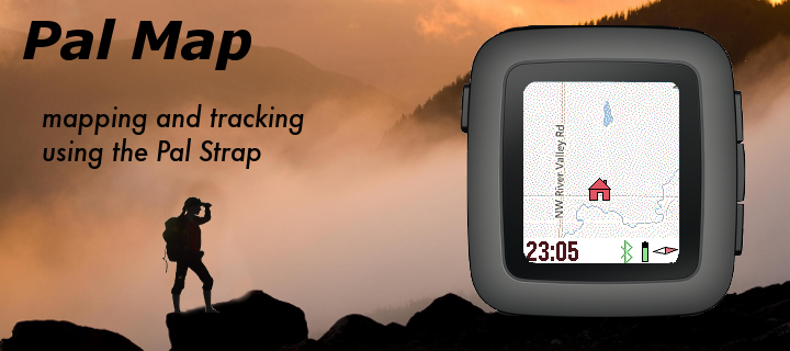
Mapping on your wrist, with panning, zooming, and realtime tracking. Markers can be dropped and distances estimated.
And the best feature? Designed for Pal Strap (but works without it also).
Top button for backlight, and bottom button to pan map based on watch tilt. Press middle button for zooming, panning, and access to the menu. The menu has Pal Strap options, marker options, and the custom settings (which include mapping service, vibration, icons displayed, etc.).
There are also options for either pre-loading or clearing the cached mapping tiles on the phone.
Mapping tiles Copyright and courtesy of OpenStreetMap, OpenStreetMap contributors, Google Maps, ESRI ArcGIS, Stamen, Bing, and NOAA. Stamen data by Stamen Design (http://stamen.com); OpenStreetMap (http://openstreetmap.org) mapping tiles under Creative Commons licenses.
Latest Version: 0.3
Version History:
0.0 created April 28, 2017
0.1 beta release
0.2 bug fixes
0.3 revised caching menu